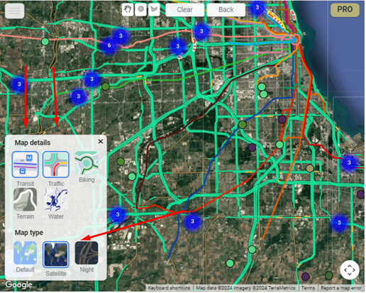
Map details
- Transit — public transportation routes.
- Traffic — real-time traffic conditions.
- Biking — bike lanes and bike-friendly routes.
- Terrain — elevation and topographic detail.
- Water — emphasized lakes, rivers, and oceans.
Map type
- Default — streets, roads, and common landmarks.
- Satellite — aerial imagery.
- Night — a darker color scheme for low-light viewing.
Note
The guide states that the selected map details and map type are preserved when the report is saved.